At the junction of Princes Street and Green Lane, against the stone wall of the former maternity hospital ‘Clairmont’, is a Boundary Stone with a Ordnance Survey Rivet on the top. The stone is marked ‘ASTPD’ (St. Peter Auckland District). This was constituted in 1872. Originally Princes Street was part of the old parish of St. Andrew. It is interesting to note that this boundary wasn’t extended to include Etherley Lane until 1894. Although badly worn the date ‘187?’ can be read. The last figure will likely be a 2.
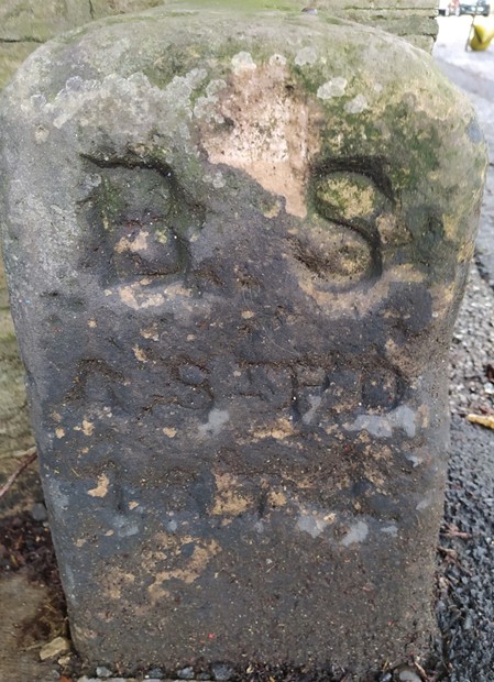
This OS cut mark found on the Boundary Stone marks a point 110.185m above mean sea level. It also has to be remembered that even by 1898 Princes Street still wasn’t a complete row of terraced houses. There were still various gaps between blocks of houses.